Consultation
In 2022, Derby City Council launched a consultation to give the public a chance to comment on plans for the area along Midland Road and Railway Terrace.
According to the council, this scheme would provide improved facilities for pedestrians and cyclists on Midland Road, Railway Terrace and Calvert Street.
The proposals included:
- Enhanced cycle links to the city centre
- Wider foot paths
- Improved pedestrian crossings
- Improved public realm
The Scheme Plans
The consultation drawing, with our annotations added, can be downloaded by clicking the image below:

Derby Cycling Group Feedback
The general theme, from a cycling perspective, was that it was unclear what the intended routes for cyclists were and where the enhancements to cycling were.
As an example, looking at the planned road markings on the corner at the Aston Court Hotel, a cyclist, heading from right to left in the drawing extract below, would leave the road and head onto a shared-use path before the lights, presumably via a dropped kerb here.

The scheme was generally lacking ambition for cycling with poor connections and disjointed links.
Revised Plans.
The council, in a media announcement on their webpage, thanked everyone who gave their feedback and have incorporated comments into the proposals where possible.
Updated plans can be downloaded by clicking the image below. Four drawings in all and, to confuse matters, the orientation is flipped round vs. to the consultation drawings. It always pays to carry a compass.

Video Ride Through
The works were scheduled to take about 8 months – So fast forward to the completed scheme shown in the video:
A detailed critique of the scheme is described below.
Midland Road
Starting from the war memorial on Midland road and working our way around to railway terrace, there’s not a lot of cycling provision but plenty of pictures of public realm improvements and walking routes.
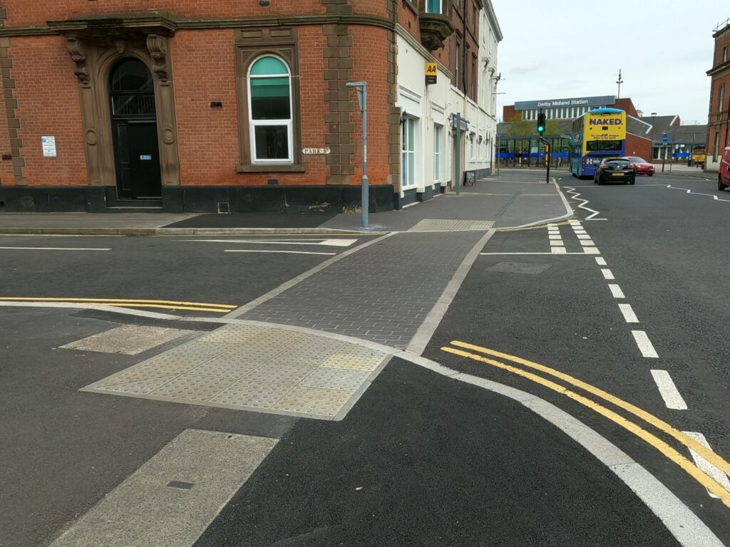
There have been improvements made to the footway, priority paving across side streets and built out junctions to improve visibility. The road markings are a little ambiguous though, so users shouldn’t expect road vehicles to yield on the new paved crossing.
Bins, Bars and Bollards
There are a number of obstacles that footway and cycleway users have to negotiate. Cars are usually the major culprits but on the old Victorian terraced streets, bins are often the serial offender.
Directly opposite the station are a number of businesses with flats above. With next to no rear access or bin storage areas, the bins end up on the street. Sometimes overflowing or not wheeled back against the premises, they become a scourge to all users.
As part of this scheme, there doesn’t appear to be a solution to this problem.
The Derby Kink
Inspired by the straight tree-lined avenues of stately homes or the Champs-Élysées that provides a 2km-long uninterrupted view from the Arc de Triomphe to La place de la Concorde, one suggestion the group made was regarding the alignment of the refurbished toucan crossing outside the Railway Station adjacent to the Waterfall public house. We thought that the crossing should be on the same bearing as Midland Place, perhaps with the additional width to separate pedestrians and cyclists to form a parallel signal-controlled crossing.
What seemed like a pretty innocuous suggestion, no doubt the designers will have 101 reasons why it couldn’t be achieved – alas, we’re stuck with a kink.


If the aims are to make places for people IE, a calm, tranquil and slower-paced environment, this could have been a great opportunity to provide a simple (non-signal-controlled) parallel crossing where people, not cars, are given priority across the road.

Even with a conservative highway department that’s nervous, as many are, about impacting car drivers, a signal-controlled parallel crossing could very easily have been accommodated in the existing space.
Making an Entrance
There are a couple of side streets off Railway terrace leading to more homes – Leeds Place and Sheffield Place. The entrances to these side streets have been renewed.
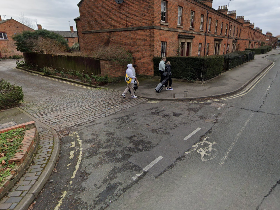


The proposed entrance bell mouth for Sheffield Place is a little excessive in grandeur for the very limited amount of vehicular traffic it will see. This is to the detriment of footway users who have to deviate from the desire line. Worse still for those in wheel chairs or the visually impaired, there’s a bit of an edge.

Crazy Paving
Whether in our back gardens or down at the allotment, I’m sure we’ve all come across the fad of laying obscure-shaped pieces of broken paving into a random pattern. But in urban environments it’s more common to see paving that was installed flat and in a uniform design transformed into crazy paving. Like crop circles, it’s a total mystery how it happens. Some theories suggest it could be road vehicles mounting the kerb and damaging the pavement which isn’t designed for such heavy loads…but that seems a little far-fetched don’t you think?


Derby Cycling Group flagged this up in the consultation. Any new pavers wouldn’t last long if delivery vehicles continued to mount the pavement.
We suggested a high containment kerb would be a better fit as bollards would reduce the effective width of the pavement as they need to be set back from the road side to reduce the risk of accidental impact.
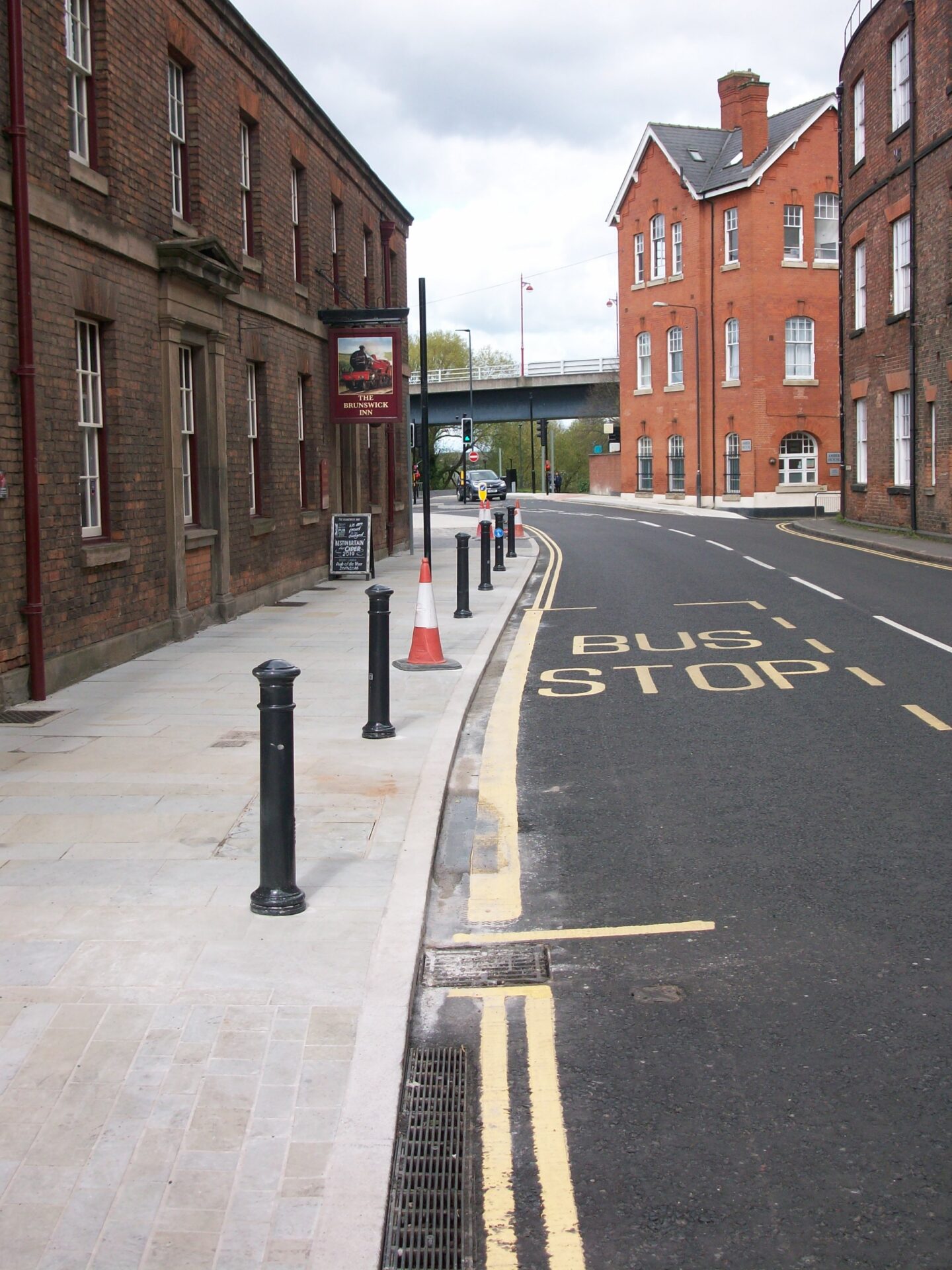
The revised plans at least included something to protect the paving, in the form of bollards no less, which would extend along the length of the path outside the Brunswick Inn.


Getting towards the end of construction, no bollards had been installed. The paving was down and complete. It was questionable whether they’d been forgotten about. It was a nervous time for all. (Ed. A bit melodramatic, Jim?)
Alas, at the last minute, the icing on the cake, a majestic row of bollards (plus a traffic cone for now) has been installed. The paving is safe!
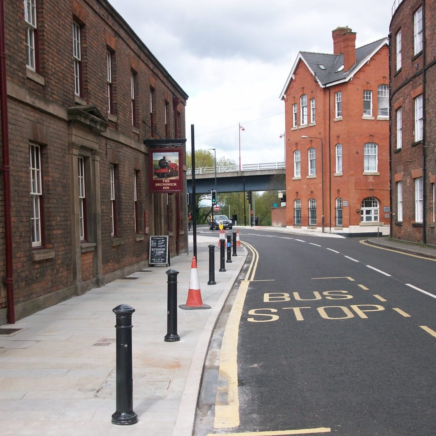
A shared-use path symbol appears on one of the bollards, but this is surely in error and would be best positioned in the little cut-through by the Brunswick towards Calvert Street.

Cobbles
Outside the Brunswick inn, cobblestones have been laid – It needs weathering a little, or some acid treatment, as the mortar infill is a little messy. The surface might look rustic but it is pretty uncomfortable for wheel chair or mobility scooter users.

Calvert Street
Calvert Street forms a direct route from the Castleward Development to the Riverside Path and Pride Park. It’s a no-through-road for road vehicles so is generally quiet.
We believed that this would be the defined route from the station to the Riverside Path and Bass Rec which avoided riding on the road.
A bonded surface was due to be laid here but the surface must have been deemed adequate. The double yellow lines have been freshened up.
Railway Heritage
Anyone who’s grabbed a pint or two in the Brunswick Inn will have seen the photos telling the story about how the cottages that grace the area were under threat from demolition but saved from the bulldozers.
The scheme falls entirely within the Railway Conservation Area but on the consultation drawings, it was proposed that the diamond blue pavers in the photo below would be removed and replaced with square concrete pavers.

While they might not necessarily be original, they are sympathetic to the local heritage and are in perfectly good condition. DCG suggested they should be retained and thankfully good sense has prevailed.
Cutting Corners
If you’re heading towards the Alexandra Hotel from the railway station, the pavement used to be narrow on both sides of the road. This gave an unwelcoming impression and made you question whether this is indeed a legitimate route for walking or you’ve stumbled across a cut-through of a local urban fox.

The presence of pedestrian guard-railing is a big sign that the footway width was substandard. The scheme has opened up this area by inviting you in with a widened pavement and lack of the guard railing.

On the opposite side of the road, there has been a short section of renewed footway to link two of the toucan crossings.

The main toucan crossing has had it’s central island relocated (to accommodate a wider footway) – Buses do come a little close to the pavement on the Amber House side of the road but so far none have taken any victims.

View from above
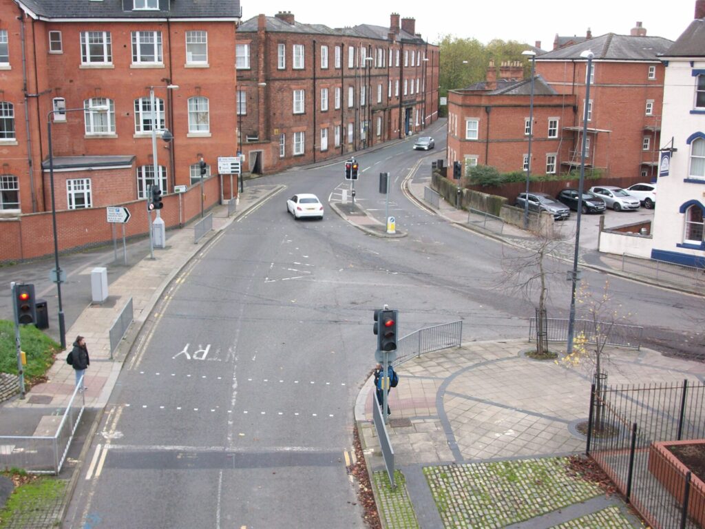
We scrambled up and over the bridge that spans the railway linking Pride Park with the rest of Derby to get a better view of the junction between Railway Terrace, Siddals Road and Station Approach
Before…
Here are a couple of photos of the view prior to the works taking place with Railway Terrace ahead and Siddals Road joining from the right.

During…
And here with the works taking place photographed from roughly the same place:


After…
And the final fresh look on a sunny day in spring.


Misc.
A few other suggestions that members fed back to the consultation included reducing the road to 20mph and making it one way.
If it wasn’t for the setting by the busy road, the cottages would be idyllic. The 30mph (plus extra at drivers’ discretion!) and the narrow pavement on the railway-side of the road make walking (and presumably living) along there not particularly joyful.
Another suggestion was to make it one way – The footway on the railway station car park side is lumpy and users must navigate around rows of mature sycamore trees. A one way system would allow widening of the footway here. The temporary one-way system (to facilitate the works) had resulted in some drivers cutting through the Castleward development along Canal Street but with the addition of some modal filters, the new(ish) development needn’t be a car-sewer.
Concluding Remarks
By improving the public realm is a mark of respect for the railway heritage and the need to provide a welcoming gateway to the city for visitors and residents using the station.
It might not have had transformational benefits for cycling, but there is some marked improvement for walkers and wheelers.
So let’s highlight (and finish on) the successes.
Successes
- Removal of pedestrian guard rails
- Protection of new footway with bollards outside Brunswick
- Protection of space outside the station apron
- Retention of heritage-style blockwork
- Widened Footways
- Use of sympathetic paving adjacent to the Brunswick Inn
- Single stage crossings
- Priority paving across Park Street
- Inclusion of wayfinding

